Japan's meteorological authorities issued urgent alerts on Friday as the country prepared to endure a dual typhoon onslaught over the weekend, with Typhoon Higos poised to make landfall from the Pacific while Typhoon Mekkhala simultaneously threatened multiple regions. The Japan Meteorological Agency cautioned residents to remain vigilant as heavy precipitation continued to pound western and eastern districts, creating hazardous conditions across much of the nation.
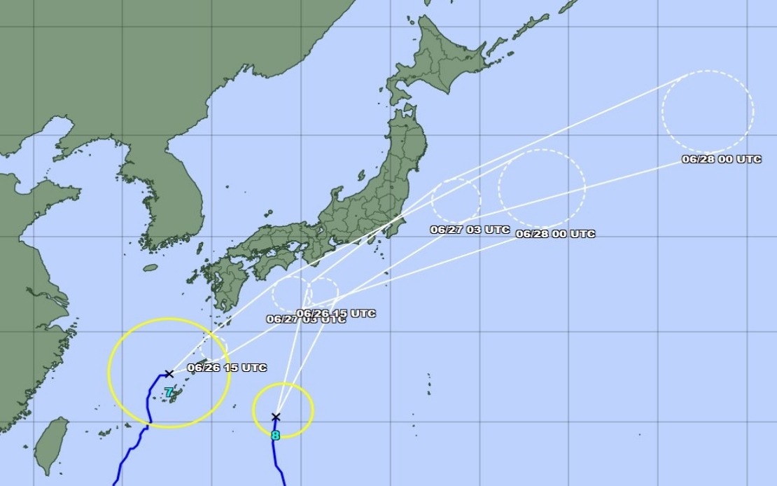
The simultaneous approach of these two weather systems presents an unusually complex challenge for disaster management officials. Typhoon Mekkhala had already reached the Amami region in Kagoshima Prefecture in southwestern Japan by Friday, with meteorologists predicting it would track toward the densely populated Kanto region the following day. Meanwhile, Typhoon Higos was anticipated to make landfall shortly after, creating overlapping periods of extreme weather that could amplify flooding and landslide risks across vulnerable areas.
The scale of the evacuation response underscores the severity of the threat. According to the Fire and Disaster Management Agency, approximately 2.3 million individuals across 13 prefectures spanning both the Kinki and Kyushu regions had received evacuation orders by 7 am local time on Friday. In Seika, Kyoto Prefecture, authorities escalated to the highest level 5 emergency safety alert for certain neighbourhoods after a destructive landslide struck during the morning hours, highlighting the immediate dangers posed by the relentless downpours.
Rainfall totals recorded across the affected regions demonstrated the extraordinary intensity of the precipitation event. The city of Goto in Nagasaki Prefecture accumulated 600 millimetres of rain between Tuesday and Friday morning alone, whilst Aso in Kumamoto Prefecture and Ureshino in Saga Prefecture each received more than 500 millimetres during the same period. These measurements substantially exceeded typical rainfall for the season and left saturated soil conditions particularly vulnerable to further destabilisation.
The Japan Meteorological Agency projected that conditions would deteriorate further as both typhoons advanced through the weekend. The Tokai region, lying directly in the path of the approaching systems, faced forecasts of up to 300 millimetres of additional rainfall by noon on Saturday, whilst the Kanto-Koshin region was expected to receive approximately 150 millimetres. The agency warned of particularly strong storm activity across Okinawa Prefecture and throughout eastern Japan, with rainfall anticipated to persist and intensify as Typhoon Higos moved northward along the country's southern coast.
For Malaysian and Southeast Asian observers, this convergence of severe weather phenomena offers instructive lessons regarding disaster preparedness and early warning systems. Japan's meteorological infrastructure, considered among the world's most sophisticated, relies on advanced satellite monitoring and predictive modelling to provide populations with sufficient lead time for evacuation and resource mobilisation. The coordinated response involving multiple government agencies demonstrates how institutional preparedness can mitigate human casualties despite overwhelming natural forces.
The trajectory of both typhoons revealed the complex atmospheric dynamics at play. As of 11 am local time Friday, Typhoon Mekkhala maintained a northeastward movement at 15 kilometres per hour whilst positioned off Kume Island in Okinawa. The meteorological agency indicated that both weather systems would gradually weaken into extratropical cyclones as they progressed inland, though this transition would not immediately eliminate hazards such as severe flooding, landslides, and high winds.
The convergence of these twin typhoons during a single weekend represents a relatively rare meteorological occurrence with significant implications for Japan's infrastructure and public safety. The overlapping rainfall periods mean that rivers and drainage systems already saturated from the first typhoon's passage must absorb additional moisture from the second system, substantially increasing the probability of catastrophic flooding in low-lying areas and narrow valleys where water drainage is naturally constrained.
Southeast Asian nations, particularly those in typhoon-prone regions, should note how Japan's structured evacuation protocols and multi-tiered alert systems function under extreme stress. Malaysia's own monsoon seasons and occasional tropical cyclone threats make Japan's experience relevant to regional disaster management policy. The concentration of over 2 million evacuees highlights the resource demands of managing large-scale population movements and the importance of pre-positioned emergency supplies and shelter capacity.
As the weekend approached, Japanese authorities maintained heightened vigilance over landslide-prone mountainous regions and areas with aging infrastructure vulnerable to water damage. The comprehensive nature of the evacuation orders, spanning multiple prefectures and affecting millions, reflected official determination to prioritise life safety over economic disruption. Emergency response teams positioned themselves strategically to respond rapidly once the typhoons made landfall, whilst hospitals and medical facilities prepared for surge capacity demands from weather-related injuries and stress-induced health emergencies.
The meteorological agency's emphasis on public alertness regarding secondary hazards such as landslides and flooding proved particularly crucial given the saturation levels recorded across western regions. Soil conditions following 500 to 600 millimetres of accumulated rainfall become mechanically unstable even on relatively gentle slopes, meaning additional precipitation from the approaching typhoons could trigger cascading terrain failures affecting transportation networks, communication infrastructure, and residential areas situated on hillsides.